


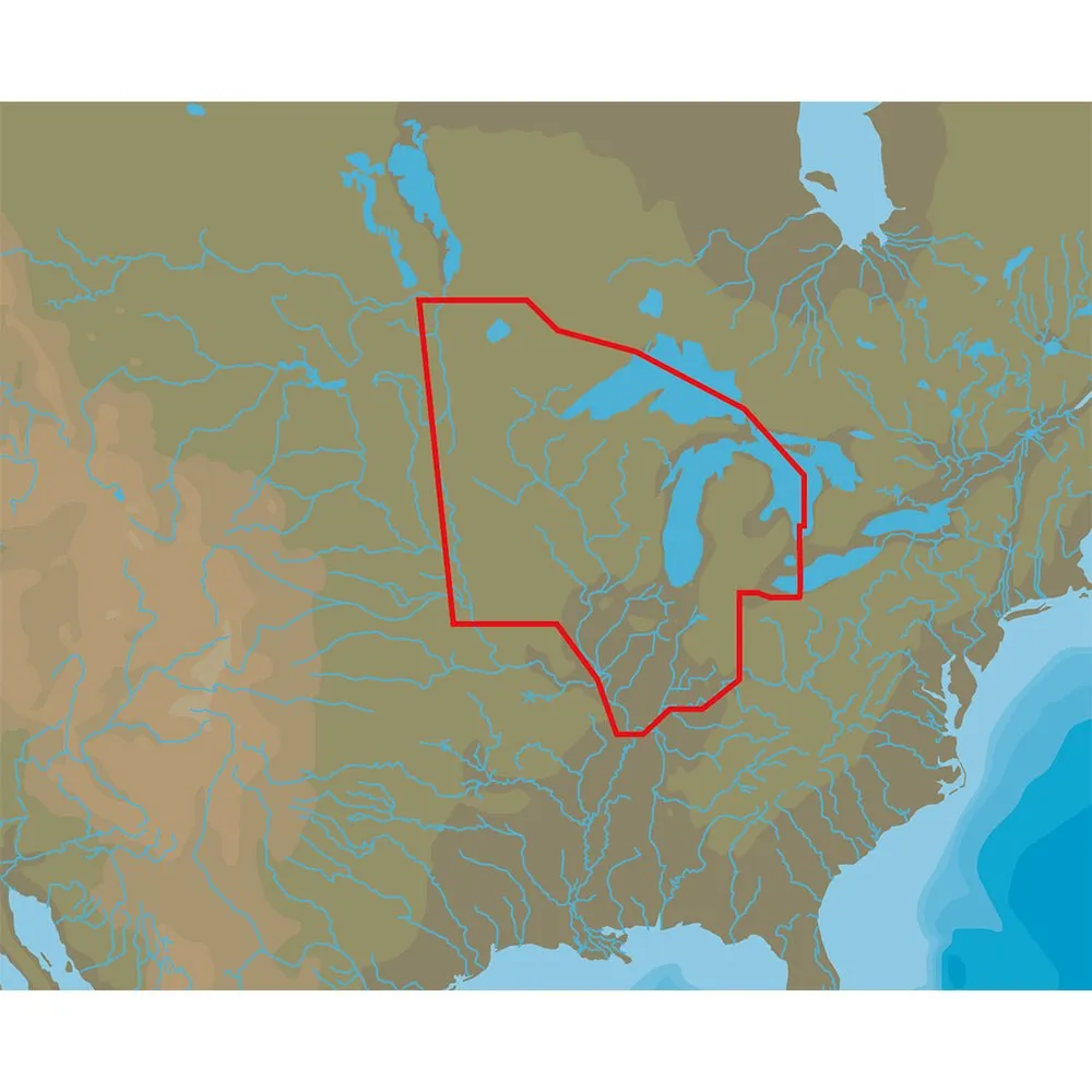
4D Lakes NA-D072 North Central
C-MAP charts have long been held in high regard by boaters because they combine aesthetically pleasing vector electronic charts with reliable sources. When buying C-MAP boaters can be assured that the charts they are getting are of the highest standard.
C-Map 4D will provide boaters with charts packed additional features such as raster chart views or Satellite images* to maximize situational awareness.
Coverage Area:
Lakes and major rivers of North Central region of USA including states of: Minnesota, Wisconsin, Michigan, Iowa, Illinois, Indiana. Includes coverage of Lake Michigan, Lake St. Clair, portions of other Great Lakes.
Specifications:
- Card Format: MicroSD/SD
- Box Dimensions: 1"H x 5"W x 8"L WT: 0.2 lbs

![KVH TracNet H90 Ku-Band Antenna w/TracNet Hub [01-0441-11]](https://www.trekkinggpro.shop/image/kvh-tracnet-h90-ku-band-antenna-wtracnet-hub-01-0441-11_NJw2V4_300x.webp "KVH TracNet H90 Ku-Band Antenna w/TracNet Hub [01-0441-11]")


